
CitySensor
A privacy-compliant, solar-powered hardware sensor that counts people, bicycles, and vehicles in real time with computer-vision AI — ruggedized ground-truth measurement for parks, trails, facilities, parking areas, and event venues.
- From $199/month
- Unlimited users
- Available through NASPO
How agencies put CitySensor to work
From trailheads to event venues, CitySensor delivers the accurate, real-time ground truth agencies rely on.
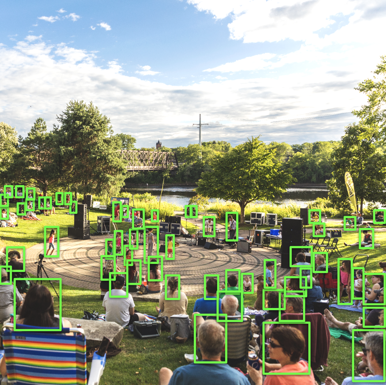
Park & Trail Counting
Mount a sensor at a trailhead, park entrance, or open space and get accurate, continuous visitor counts — no clickers, no manual surveys, no guesswork.
Event & Venue Attendance
Measure real crowd sizes at festivals, concerts, sports venues, and gatherings with automated computer-vision counts you can defend to sponsors and council.
Multimodal Traffic Counts
Count people, bicycles, cars, buses, and trucks at intersections, roads, and paths to inform mobility, safety, and complete-streets decisions.
Ground-Truth Calibration
Convert sensor counts into ground truth that calibrates and fine-tunes CityData's mobility big-data models — so every modeled number is validated against reality.
Parking & Facility Utilization
Track how heavily parking areas, lots, and facilities are actually used across the day, week, and season to right-size operations and investment.
Weather-Correlated Planning
Because each sensor logs weather alongside counts, you can separate weather effects from real demand and plan staffing and programming with confidence.
The many ways CitySensor empowers your agency
An impressive collection of features and capabilities that make CitySensor the most accurate, private, and rugged way to count what happens on the ground.
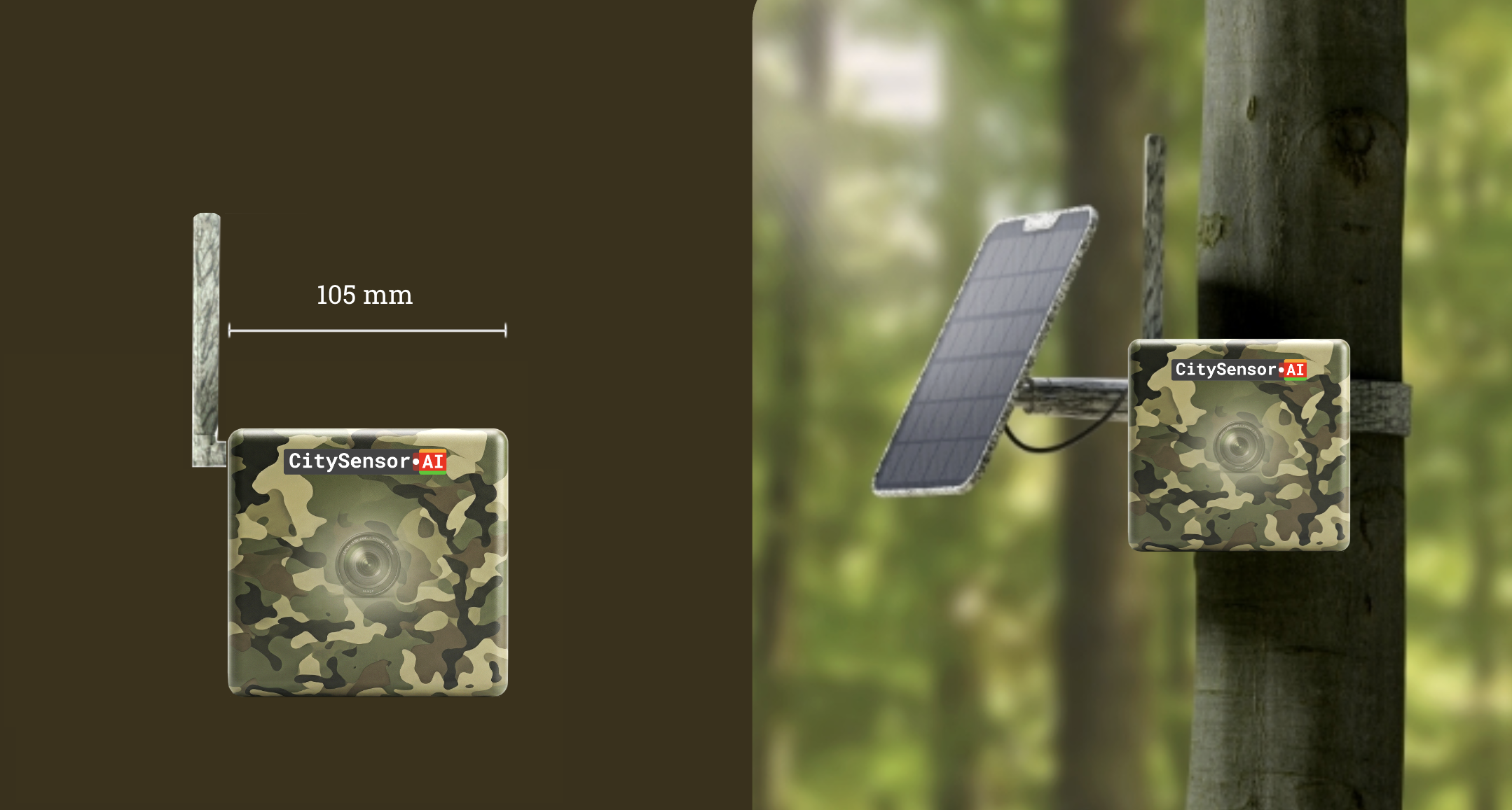
Ruggedized & Weatherproof
IP64 weatherproof and built for -10°C to 55°C, the sensor mounts to lighting poles, walls, or park furniture and runs through the seasons.
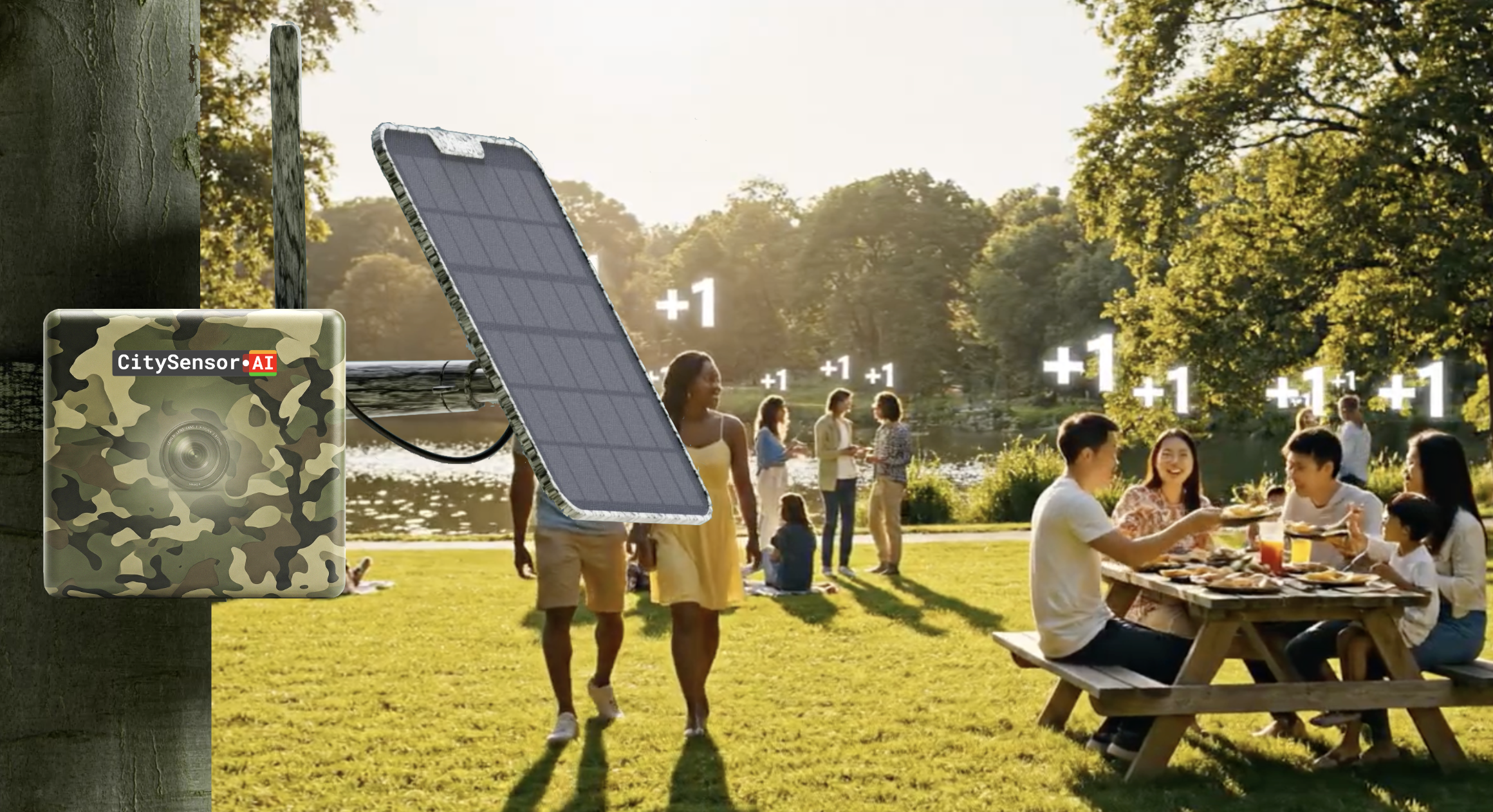
Solar-Powered & Wireless
A 6W solar panel and 6000mAh battery keep the sensor running with no trenching or wiring — deploy anywhere the sun reaches.
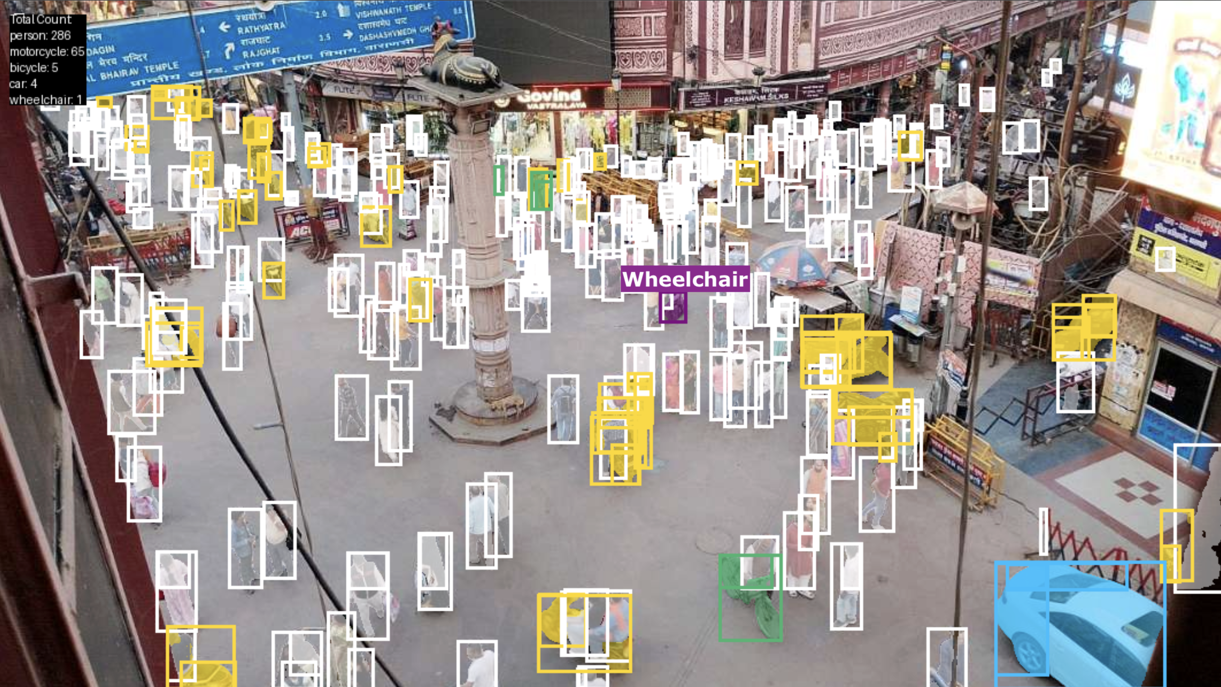
Computer-Vision Counting AI
Automated, real-time counting powered by computer-vision AI running on Google Cloud — accurate counts without any manual tallying.
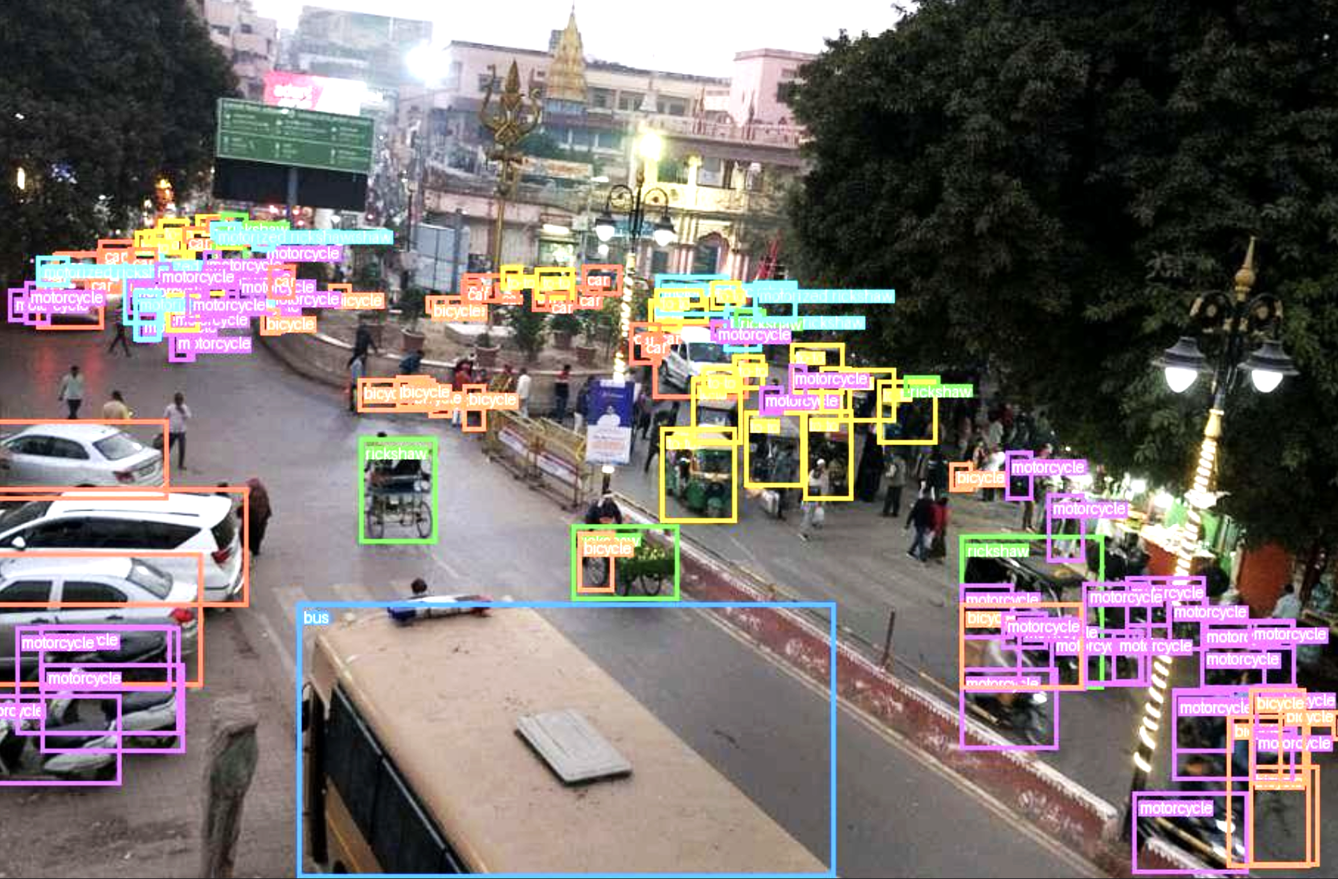
Multi-Object Tracking
Counts and classifies people, bicycles, cars, vans, buses, trucks, motorcycles, and trains — every mode, from one device.
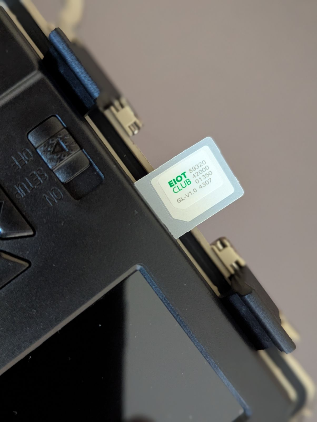
4G / 5G Cellular Connectivity
Global LTE and 5G bands with an included data plan stream counts straight to the cloud — no local network or IT integration required.
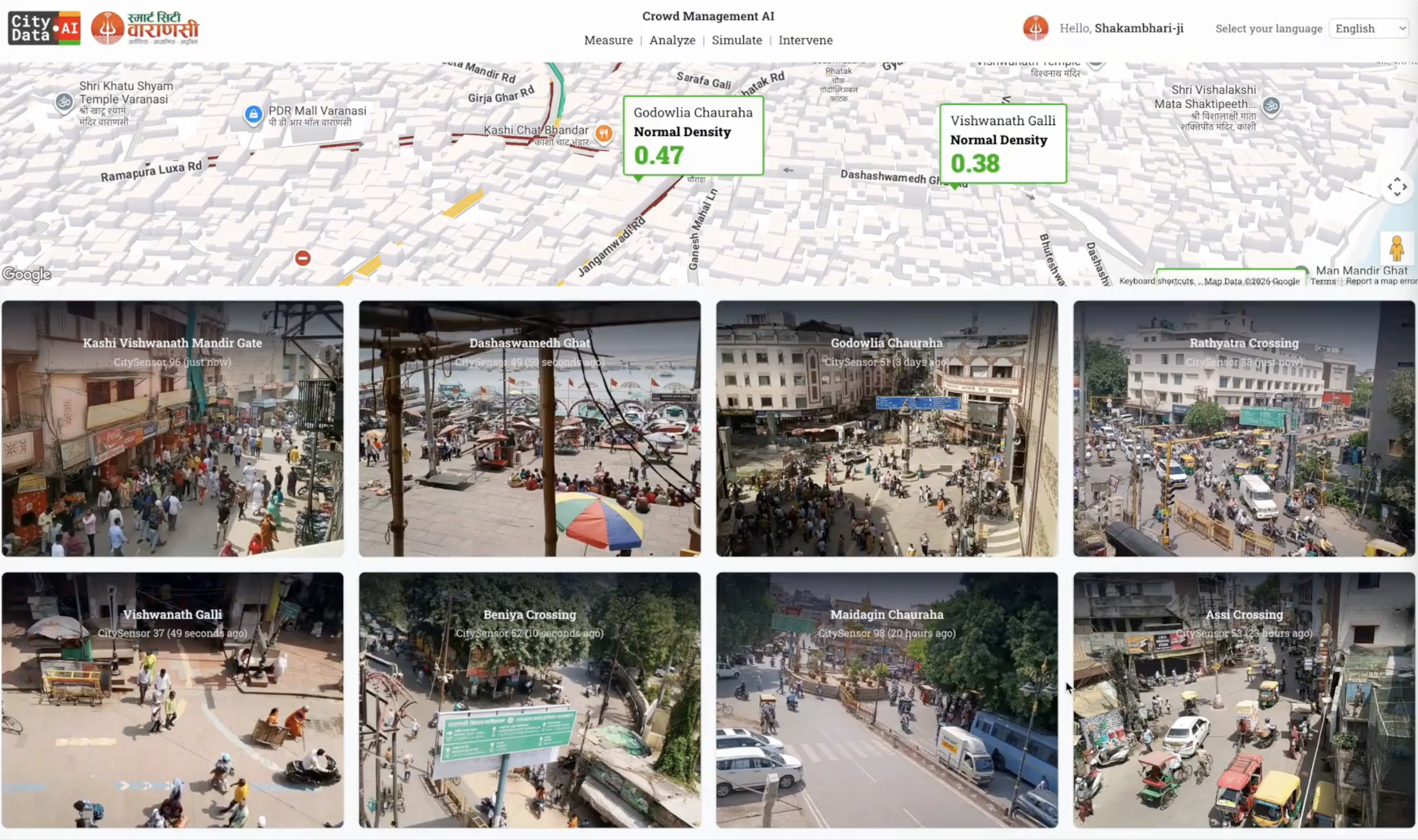
Real-Time Data Dashboard
An online dashboard that works in any browser — minute-by-minute, hourly, and daily counts, plus sensor uptime and summary metrics.

4K Camera with Night Vision
A 4K 8MP Ultra HD camera that pans 355° and tilts 140°, with no-glow infrared night vision to 10 meters for 24/7 counting.
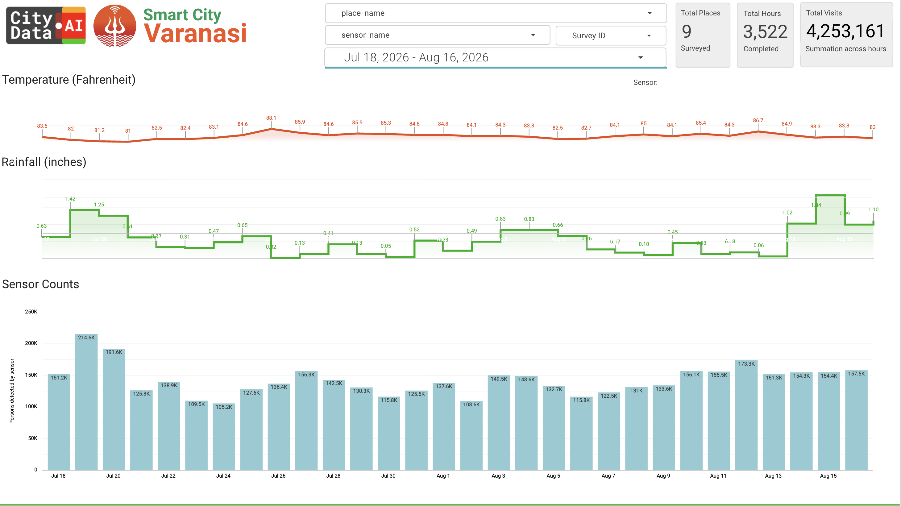
Weather Tracking & Correlations
Every sensor logs temperature, rainfall, snowfall, humidity, wind speed, and visibility, so counts come with the weather context behind them.
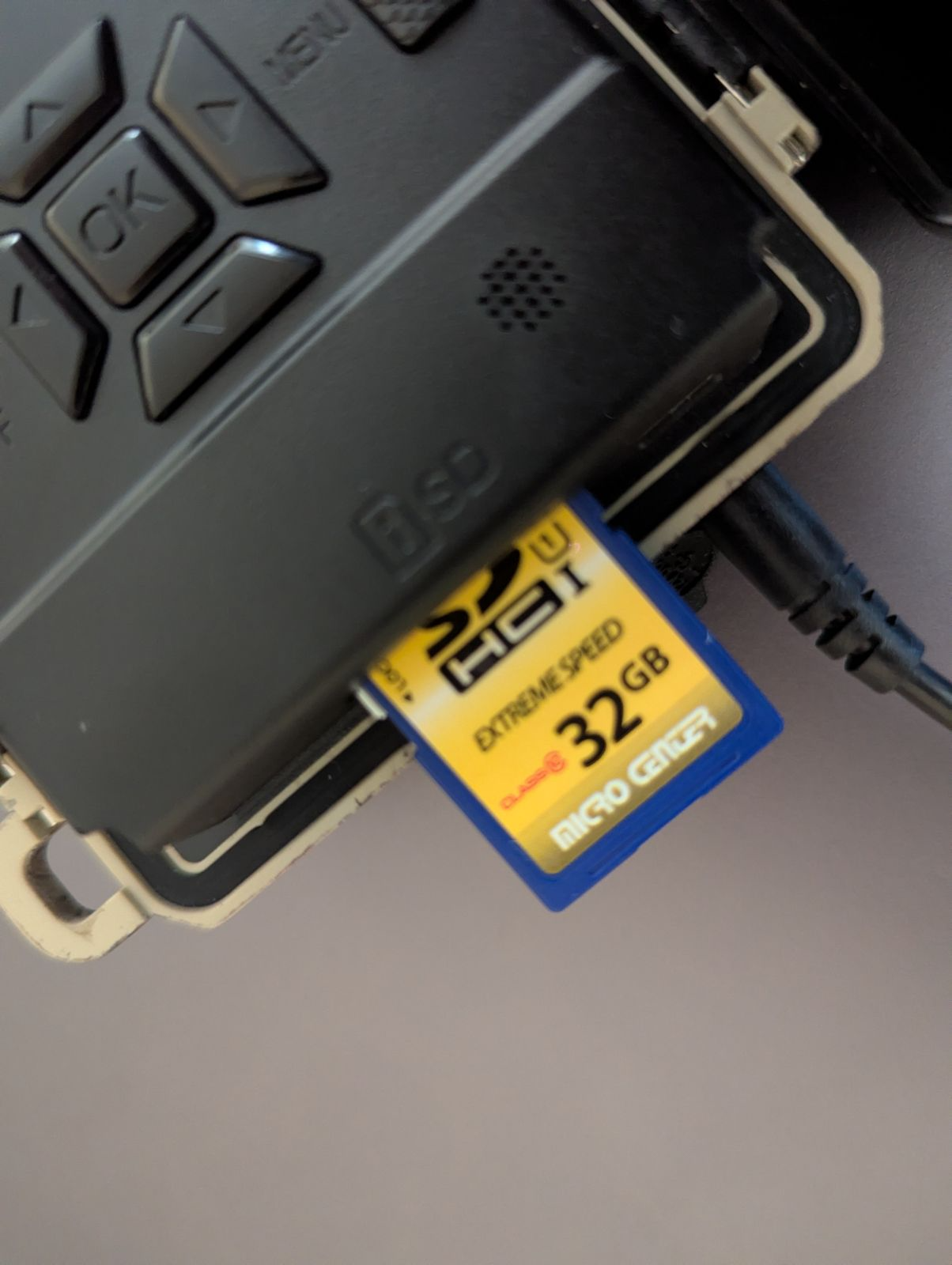
Local Storage Card
An onboard SD card slot adds high-capacity local storage, so images are saved on the sensor itself while images and metadata stream to the cloud in parallel.
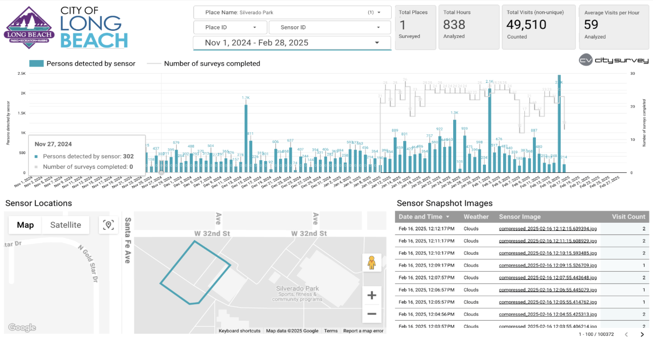
Ground-Truth Calibration
Sensor counts become the ground truth that calibrates and fine-tunes CityData's crowdsourced counting models — accuracy that compounds across your system.
Everything included
The full CitySensor service, standard with every sensor you lease.
- Ruggedized sensor hardware included in the lease
- Cloud storage and AI compute included
- 4G/5G cellular data plan included
- Dashboard works in any browser — unlimited users
- Remote management & auto updates, no truck rolls
- Configurable time-lapse intervals (10/30/60s)
- Counting only — no facial recognition, ever.
- Snapshot images stored per agency preference
- Time-lapsed snapshots upload to Google Cloud
- Integrates with every CityData product
- Dedicated Customer Success Manager and Account Manager
- AI model calibration across all CityData products
Works better together
CitySensor is part of the Parks, Trails, & Natural Resources solution. Pair it with these products:
CityParks
Accurately quantify usage for your parks, trails, facilities, and natural resources, to make data-driven decisions for budget allocation.
Learn more →CitySurvey
Capture the ground truth data in real time by setting up surveying apps on any mobile device in parks, trails, events, downtowns, & intersections.
Learn more →CityBase
Reserve, register, and book recreation programs, events, passes, campsites, picnic shelters, cabins, golf tee times, marina boat slips, with real-time availability and contactless checkout.
Learn more →CityOps
Optimize operations, manage tasks, fleets, assets, and field workforce with advanced geospatial AI workflows and agentic systems.
Learn more →Simple, single-tier pricing
everything included $200/sensor/month
One simple lease — includes the sensor hardware, cloud storage, AI compute, and the 4G/5G cellular data plan. Requires a minimum commitment of two years.
Onboarding & Setup
Initial provisioning, account setup, and dashboard configuration for your agency.
Installation & Maintenance
Physical mounting of sensors on your infrastructure, plus ongoing maintenance and servicing.
Custom Features
Fine-tune the standard CitySensor features, app UX, dashboard, and the AI model to meet your specific needs.
Branding
Add your organization's branding elements like your logos, icons, and custom domain links for internal and external use.
Additional costs to plan for — scoped with you before you sign.
Contact Us for a Demo & Pricing